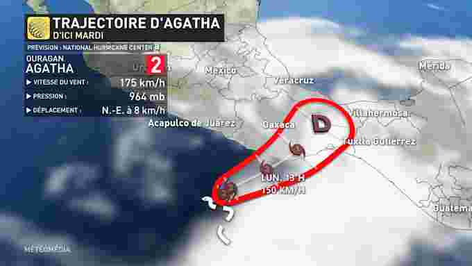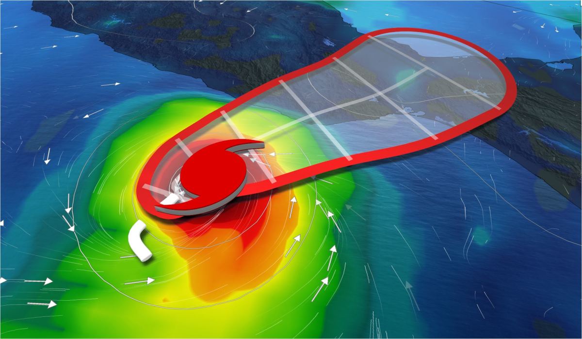
Sunday May 29, 2022 8:15 p.m. – Agatha becomes the first hurricane to form in the Pacific Basin and the consequences of its passage could be devastating.
Briefly :
- The southern coast of Mexico was affected;
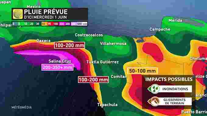
- 350+ mm of rain in some areas;
- Sustainable winds of up to 155 km/h.
Agatha reached Category 1 status on Sunday morning, and during the evening, it was upgraded to Category 2. The strong system may continue to multiply, reaching the Category 3 threshold before it hits the ground. Agatha is moving at 5 km/h towards the coast of Mexico, which is expected to hit it during the day Monday.
So it shouldn’t reach a force worthy of a major hurricane, but can still sow chaos in its path. Officially, hurricane season begins on May 15 in the eastern Pacific Ocean.
Serious consequences?
The potential effects of this storm are diverse. First of all, the risks of floods and landslides are very present. The Salina Cruz region will be particularly affected by heavy rain, with 350+mm of rain expected by next Tuesday. The surrounding areas will receive between 50 and 200 mm of rain.
There will also be flashes from Monday, with winds reaching 155+ km/h, particularly in the south of the country. A power outage is expected.

