Briefly :
- Dead calm in the Atlantic.
- The first hurricane was delayed compared to the average;
- Work can be resumed soon.
In the past seven years, the first tropical storm has appeared in the Atlantic basin ahead of the season’s official start on June 1. These rushing events helped give the impression that the season was sluggish so far. In fact, the first order of 2022, Alex, arrived only a few days after the official date, i.e. June 5. After that, Bonnie rehearsed on July 1 and Colin followed suit the next day.
Since then, it has been radio silence in the Atlantic. No system has been developed that is powerful enough to be named. One of the factors that explain this calm is the presence of sand coming from the desert, which came to put wheels in the wheels of tropical activity.
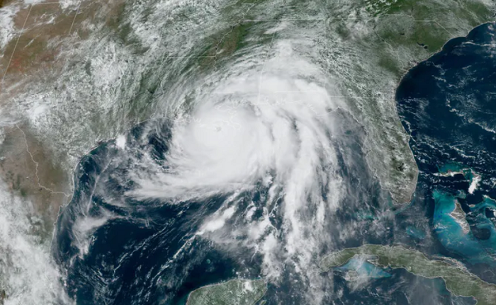
For the first time since 1982, the Atlantic did not see any specific storms between July 3 (after Colin) and August 26. By comparison, at least nine named storms formed on this date last year. One of them, Ida, even developed into a Category 4 hurricane, becoming the strongest hurricane to make landfall in the southern United States since Hurricane Katrina in 2005.
Despite the appropriate context…
It’s a little weird, because the context is perfect for an active season. The presence of La Niña, a cold water anomaly located in the Pacific Ocean, often greatly amplifies tropical activity. Even if the phenomenon continues, it is not enough to see storms worthy of the name.
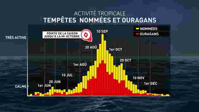
So the basin accumulates some delay: On average, the first cyclone forms around August 11. It usually takes until September 1 to see the first major hurricane, either Category 3 or higher on the Saffir-Simpson scale. At the moment, there is no indication that this limit will be reached.
The peak is approaching
However, the situation can change quickly. The most active period of hurricanes is approaching: the peak is generally reached at the beginning of September. Then the water temperature in the tropical Atlantic basin is at its warmest. The winds are also somewhat calmer due to less contrast between the air masses. This context means that shear is lower, a component that hinders tropical storm formation. La Niña can also contribute to increased activity over the coming weeks.
Two regions are currently being monitored towards South America. The development of tropical activity cannot be ruled out, which may breathe new life into the season. The situation will be closely monitored over the next few days.
NOAA is still predicting a very active season, with between 14 and 20 systems named by the end of November. Of those, six could become hurricanes, and three to five could reach the major hurricane threshold.


